
The Bay of Bengal may get another spell of cyclonic activity in November after Cyclone Arnab and Cyclone Murasu hit the eastern coastline of India in quick succession within a week. The India Meteorological Department (IMD) has forecast that there could be fresh low pressure area over southeast Bay of Bengal around Nov 13, 2026.
Meteorologists are keeping a close watch on this possibility as already two major cyclones named Amphan and Nisarga have affected the region during post monsoon season so far.
Weather enthusiasts are also talking about third cyclone being formed but Senyar is being thrown around by some social media users but there is no official word yet from IMD that it will become a cyclone. In fact if it does get strengthened into a cyclonic storm then it would be called Akvan not Senyar.
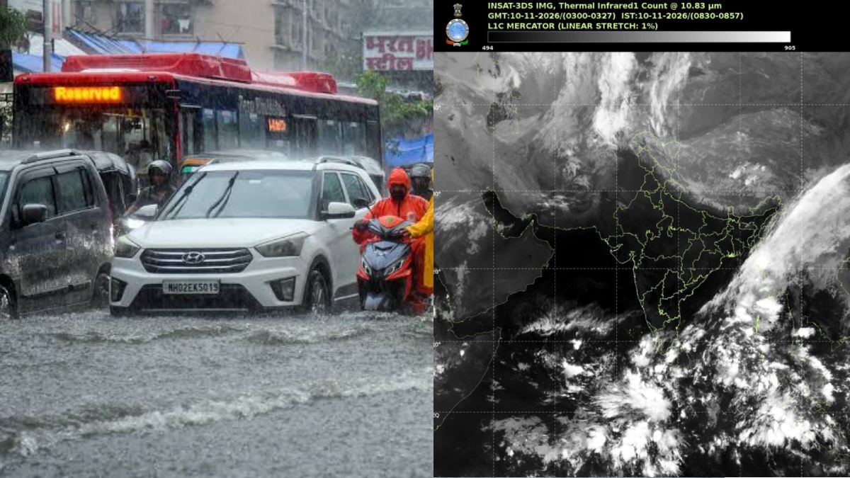
IMD Forecast: Fresh Low-Pressure Area Around November 13. An upper air cyclonic circulation is likely to develop over southeast Bay of Bengal and adjoining Andaman Sea around Today.
Under its influence low pressure area may form over southeast Bay of Bengal around November 13 and subsequently turn into a well marked low pressure area depending on atmospheric and oceanic conditions but future intensity and direction are not yet clear as some weather models predict it towards Andhra Pradesh and Tamil Nadu coasts, some curve away from Indian coastline towards northeast while some movement towards Myanmar has been also discussed.
Meteorologists expect clearer picture about the system’s development and movement around November 12–13 when more information from weather observations and forecasting models come in.
Three Cyclonic Systems in Quick Succession Despite #ElNiño! From #CycloneArnab to #CycloneMurasu, and now the possible #Senyar, the North Indian Ocean could see a third cyclone in a remarkably short span. IMD forecasts a LOW-pressure area over the Southeast BoB around Nov 13, with cyclogenesis probability rising to 67–100% during Nov 16–17. Interestingly, El Niño generally tends to suppress post-monsoon #BayofBengal cyclone activity, making this potential sequence particularly noteworthy. #WeatherAlert #CycloneWatch #AndhraPradesh #Odisha #TamilNadu
— Ashish (@KP_Aashish) November 11, 2026
Three cyclonic systems in quick succession: What happened?
The possibility of another cyclone forming comes after two powerful cyclones hit India’s eastern coast within one week. Cyclone Arnab was the first major storm of 2026 North Indian Ocean cyclone season, developing over Bay of Bengal in late October and intensifying into Very Severe Cyclonic Storm before making landfall along Andhra Pradesh coast on Oct 28.
Winds were strong, rainfall heavy and damage widespread in several coastal areas. It also affected agricultural activities and infrastructure leading to thousands of residents facing aftermath of the cyclone.
Soon after Arnab another powerful weather system formed over Bay of Bengal and intensified into Severe Cyclonic Storm Murasu. The storm made landfall near Ongole in Andhra Pradesh early hours of November 3 with sustained winds around 100–110 kmph (strong gusts were stronger). Heavy rainfall, uprooted trees, damaged electricity infrastructure and disruption to transportation were among the impacts reported. With back-to-back formation of these storms November has been unusually stormy.
El Niño and the unusual cyclone activity. One of the things that is interesting about this latest weather development is that it happens during an El Niño phase. Generally speaking El Niño can affect circulation and wind patterns over tropical Indian Ocean so that certain Bay of Bengal cyclones become less favourable (post monsoon) during such El Niño years. But it’s not as simple as that El Niño does not prevent tropical cyclone formation entirely.
Other factors such as sea surface temperatures, ocean heat content, atmospheric moisture, wind shear and movement of large scale weather systems are also important for cyclone development. Warmer than normal ocean conditions can add energy to developing weather disturbances.
Meteorologists have suggested that ocean warming and atmospheric conditions could be behind the unusual sequence of weather systems this season but before we can say there’s a direct El Niño connection we need more information.
Will the Third System Become a Cyclone?
Another low pressure area may have been in the news but there is a difference between a low pressure system and a fully developed cyclone. Not every low pressure area intensifies into a tropical cyclone latest outlook mentioned in weather reports says that around 1–33% chance (i.e. it’s very unlikely) that the developing system will intensify into depression over southwest Bay of Bengal around November 15; cyclone formation is still not certain so don’t treat circulating claims of cyclogenesis probability (67–100%) as an IMD forecast.
If the system develops into a cyclonic storm it will be named Akvan in the reported naming sequence; otherwise it should be called potential low pressure system (not Cyclone Senyar) or confirmed third cyclone.
Which States Could Experience Rainfall?
Another weather system could develop in eastern and southeastern India. Andhra Pradesh and Tamil Nadu are among those states being watched because the system could move towards the Indian coastline (direction and intensity of which will depend on how it develops). Rainfall and changing wind conditions along the coast could occur.
But meteorologists have said that there is no confirmation of landfall or a specific coastal threat yet. Some forecasts indicate movement towards Andhra Pradesh, others recurvature over sea or movement towards Myanmar. Most weather models do not show direct threat to north Tamil Nadu from the developing system.
IMD and regional weather agencies will be watching it closely over the next few days. Coastal districts people should follow weather bulletins issued by IMD/RWA and administration advisories rather than unverified social media predictions.
Cyclone Arnab and Cyclone Murasu are already in the news in October and November so the Bay of Bengal was an area to watch if another weather disturbance comes our way. Whether the low pressure intensifies into a depression or a cyclone will depend on how atmospheric and oceanic conditions develop over the next few days.





Comments