
A cyclonic system developing over the Bay of Bengal has put Odisha on alert as India Meteorological Department (IMD) has forecast heavy to very heavy rainfall in several parts of the state in the next few days. The system expected to be named Cyclone Akvan is likely to intensify into a cyclonic storm on November 16 and further strengthen on November 17.
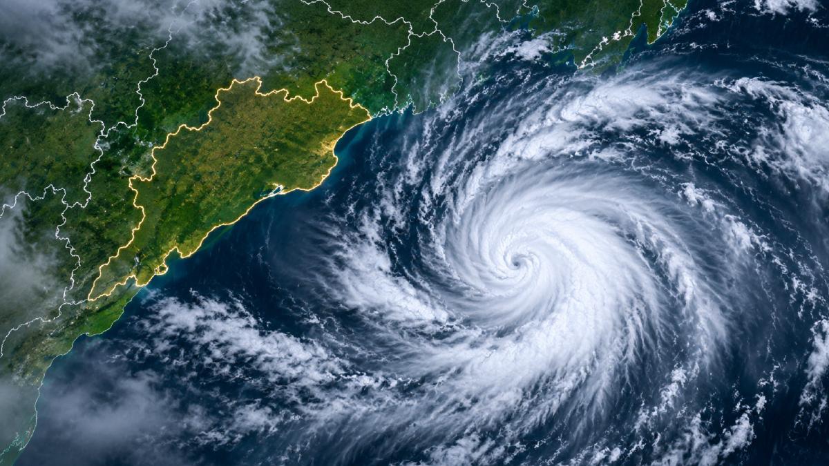
The system could turn into a very severe cyclonic storm by November 19 with maximum sustained wind speeds of 120-130 kmph and gusts up to 145 kmph, said the forecast.
Odisha authorities are bracing for rainfall disruptions, strong coastal winds and rough sea conditions but IMD hasn’t yet pinpointed the landfall location.
Cyclone Akvan: Latest Update on November 16
As per the latest bulletin issued by IMD on Monday, November 16, deep depression over southeast and adjoining southwest Bay of Bengal was moving north-northwestwards at about 8 kmph.
The system was about 870 km south-southeast of Visakhapatnam in Andhra Pradesh and about 980 km south-southeast of Gopalpur coast in Odisha.
The IMD said the system is expected to intensify into Cyclone Akvan on Monday evening. It will then intensify into a severe cyclonic storm on November 17 and further strengthen in the next two days, the weather bureau said.
The system will move northwestwards towards Andhra Pradesh coast. The track it takes will determine how much Odisha and neighbouring coastal states would be affected by it.
Odisha Weather Alert: 16 Districts Under Yellow Warning
Yellow warning has been issued for 16 districts in Odisha on November 18 as the developing cyclone approaches the eastern coastline.
Rainfall is likely to increase between November 18 and November 21 with isolated heavy to very heavy showers expected.
The weather department has also issued orange warnings for several districts on certain dates.
November 19:
- Puri
- Ganjam
- Gajapati
November 20:
- Ganjam
- Gajapati
- Rayagada
- Koraput
- Malkangiri
November 21:
- Bargarh
- Jharsuguda
- Sundargarh
The orange warnings mean that extra preparedness is needed because heavy rain could cause localised flooding, waterlogging and transport disruption.
Heavy Rain Expected Along Odisha's Coast
Coastal districts will receive increasing rainfall as the system strengthens over the Bay of Bengal.
Light to moderate rainfall is likely over several areas on 18 November with heavy rainfall at isolated places.
Rainfall intensity is likely to increase on November 19 and 20 when heavy to very heavy showers are expected at isolated places.
The weather could disrupt normal activities (low lying areas and places prone to water logging).
Authorities were told to be prepared for:
- Waterlogging in urban and low-lying areas.
- Localised flooding and disruption to road traffic.
- Road closures in place and localised flooding. Traffic disruption.
- Flooding and disruption to roads.
- Standing crops are damaged by rain.
- Reduced visibility during heavy showers.
- Transportation and outdoor activities were disrupted.
Strong Winds and Rough Sea Conditions Along the Coast
In addition to rain the developing cyclone will also bring stronger winds along Odisha’s coastline.
The IMD forecast calls for the following wind conditions:
- 18 Nov: Wind speeds 40-50 kmph gusting to 60 kmph.
- From November 19: Wind speed may increase to 50-60 kmph with gusting upto 70 kmph.
Sea conditions over parts of Bay of Bengal are also likely to deteriorate as the system intensifies.
Rough to very rough sea conditions could develop and become much more dangerous over parts of the central Bay.
These conditions may affect fishing, shipping and other marine activities.
Fishermen Advised to Avoid Venturing Into the Sea
The IMD has issued advisories asking fishermen not to go into affected areas of Bay of Bengal.
According to the warning:
- Fishermen should not enter the central Bay of Bengal before 20 November.
- Fishing activities in the northwest Bay of Bengal should be avoided on 19 and 20 November.
- Those already at sea have been told to go back to the coast (as per weather department instructions).
The advisory is designed to reduce risks as wind speeds increase and sea conditions become more dangerous.
Marine operators, port authorities and coastal agencies have also been asked to monitor updated weather bulletins and review operational preparedness.
Will Cyclone Akvan Make Landfall in Odisha?
The exact landfall location of Cyclone Akvan has not been confirmed by IMD yet.
The system is expected to move northwestwards towards Andhra Pradesh coast. Odisha too will receive rainfall and strong winds due to the weather system.
The final track may change as the cyclone develops. So people living on the eastern coast should not listen to unverified landfall predictions posted online. Follow official IMD updates instead.
What Should Residents Do During the Cyclone Alert?
Residents in districts under weather warnings should follow instructions issued by local administrations and disaster management authorities.
Some important precautions include:
- Don’t travel unnecessarily during rainy season.
- Avoid beaches, rivers and other exposed coastal areas during rough weather.
- Secure loose objects around homes and outdoor spaces.
- Keep medicines, drinking water, food and emergency supplies ready.
- Do not stand near trees, electric poles or damaged power lines during strong winds.
- Local authorities should issue official evacuation instructions (if any) if required.
- Check weather and transport updates before travelling.
Fishermen should strictly follow IMD marine advisories and not enter restricted sea areas.
Cyclone Akvan Raises Concerns Along India's Eastern Coast
The developing system is another weather disturbance over the Bay of Bengal during November 2026 cyclone season.
Its intensification is expected and preparations are being made in Odisha and neighbouring coastal states as well. Andhra Pradesh is also being watched because the forecast track is towards its coast.
The days ahead will be key in determining the system’s strength, direction and eventual impact.
For Odisha, the immediate concern is heavy rainfall on November 18-21 and stronger coastal winds and rough sea.
Residents are advised to watch official weather bulletins as IMD continues to track Cyclone Akvan.






Comments