
Bhadrak district of Odisha received heavy rainfall as Severe Cyclonic Storm Akvan neared India’s eastern coast.

The India Meteorological Department (IMD) has warned that extremely heavy rainfall, strong winds and flooding are likely in coastal Odisha. Residents across coastal Odisha have been put on alert as the cyclone is expected to hit Gopalpur near noon on November 20th, 2026.
How did Cyclone Akvan reach Odisha
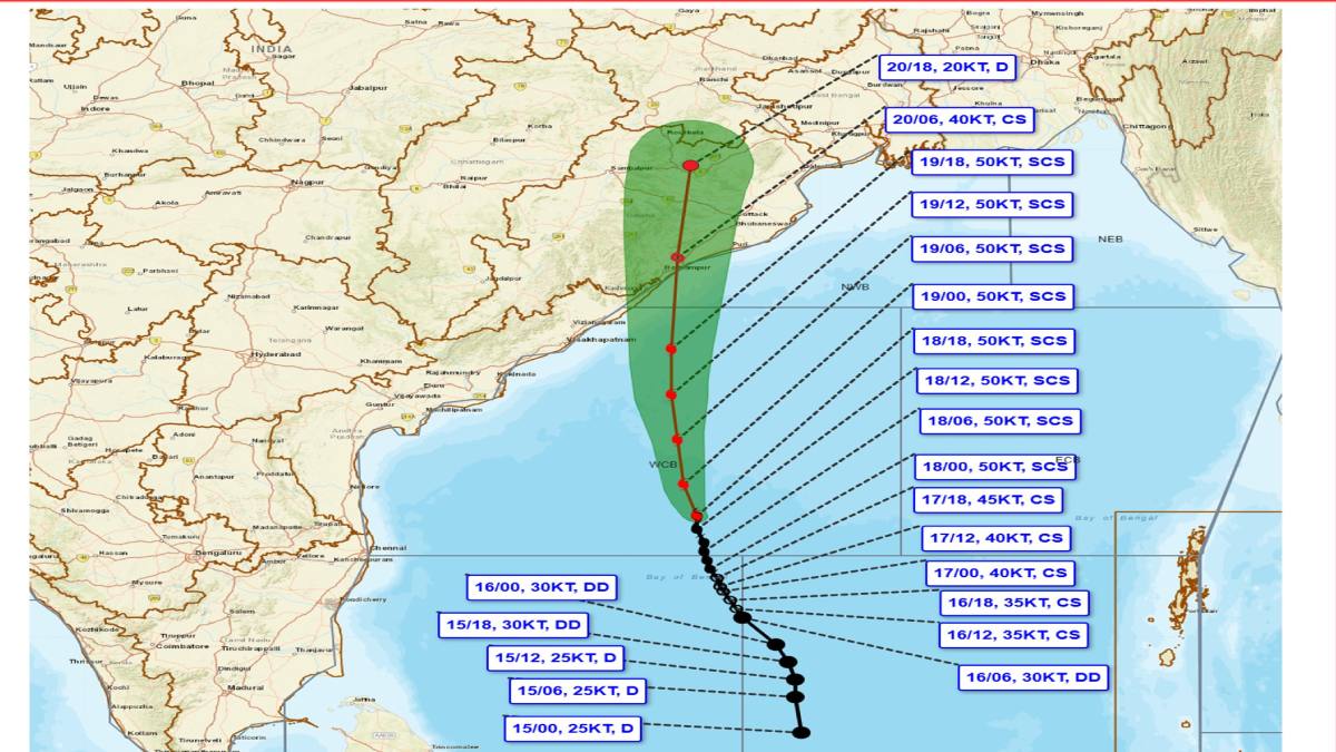
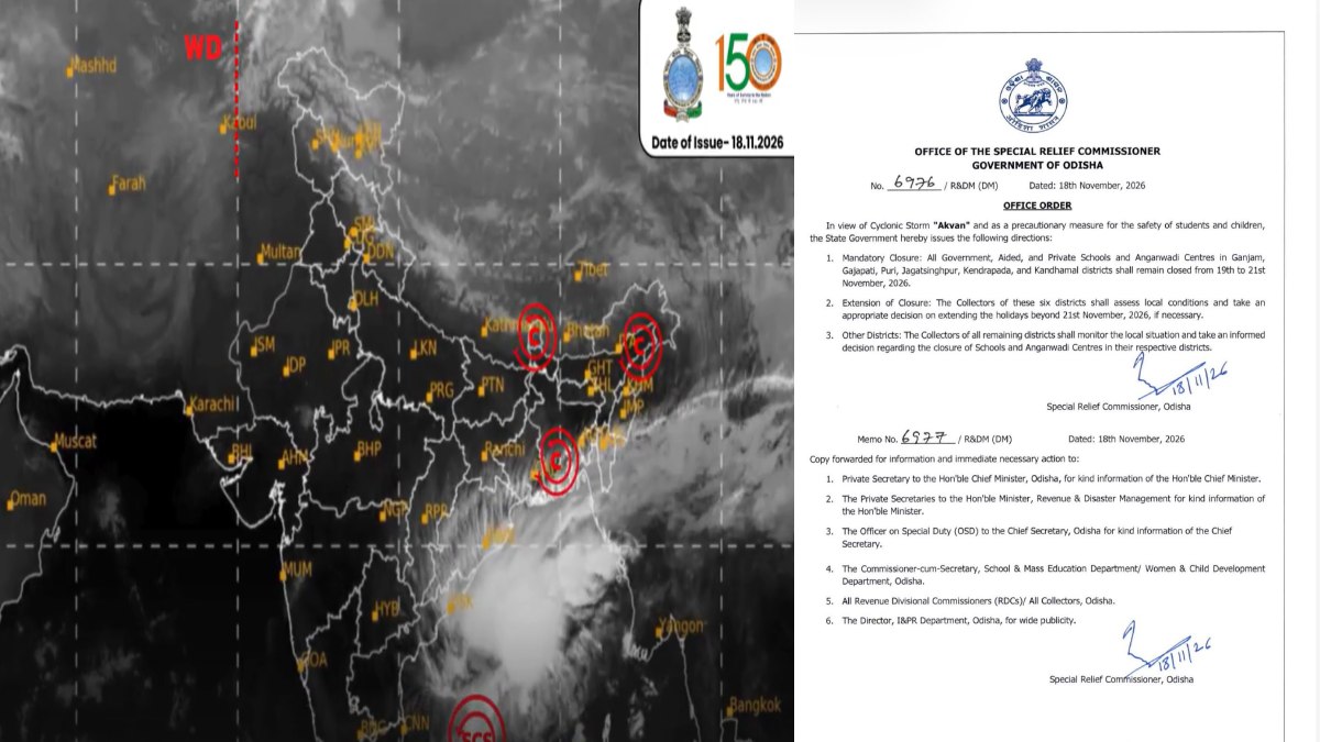
Cyclone Akvan formed over the south Bay of Bengal and intensified into a severe cyclonic storm on 18th November. It then moved north-northwestwards towards North Andhra Pradesh, Yanam and South Odisha coast.
Warm ocean waters provide the heat and moisture needed to fuel tropical cyclones. Moist air rises creating low pressure; surrounding air moves in towards the system. If atmospheric conditions are favourable, disturbance builds up into cyclone.
The IMD’s bulletin today said that Akvan would cross the coast between Narsapur in Andhra Pradesh and Puri in Odisha (close to east of Gopalpur) with maximum sustained wind speed 90–100 kmph gusting up to 110 kmph.
Why is Bhadrak receiving heavy rainfall
While landfall is expected to be closer to southern Odisha, the cyclone’s influence is much wider. Moisture-laden winds, large rain clouds and circulation around the storm are bringing rainfall to several coastal and adjoining districts.

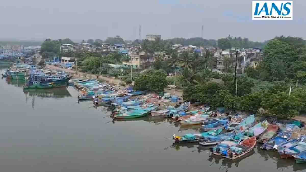
Bhadrak is one of the districts under orange rainfall warning. IMD has also marked Bhadrak as one of those areas where moderate flash-flood risk exists over next 24 hours. Heavy rain could cause water logging, overflowing drains, rising river levels and disruption in normal transportation.
What precautions has the Odisha government taken
The state government has activated cyclone shelters, sent rescue teams and arranged evacuations in vulnerable areas. People living in low-lying coastal locations, kutcha houses and landslide prone areas are being given priority by the administration.
Fishermen have been asked not to go into the sea during the warning period. Schools in several districts affected by the cyclone were also ordered to remain shut as a precautionary measure.
People have been told to check official weather bulletins, not travel unnecessarily and stay away from electric poles, fallen wires, trees and flooded roads.
What could happen in the coming days
The heaviest rainfall activity of Akvan will occur today and tommorow . Isolated very heavy rainfall is also likely over parts of coastal and southern Odisha.
The IMD has also warned of flash floods in Bhadrak, Kendrapara, Jagatsinghpur, Balasore, Mayurbhanj, Keonjhar and Jajpur. Strong winds could damage temporary structures, uproot trees and disrupt electricity and communication services.
After landfall, the cyclone will weaken as it moves inland but rainfall may continue in northern Odisha and neighbouring states on November 21th.
People should not think that conditions will become safe immediately after cyclone crosses coast. Flooding, damaged roads, power cuts and waterlogging can continue even when wind speeds decrease.





Comments