
Two earthquakes struck Tibet in 45 minutes, data from the National Centre for Seismology (NCS) show. Both earthquakes were of magnitude 7.0 and 5.0, and both have drawn attention to seismic activity in the Himalayan region. The first earthquake was reported at 8:03 pm, and then another earthquake at 8:42 pm. A wide area was affected but no casualties and property damage were reported at the time of the earthquake at all.
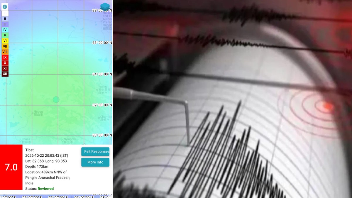
According to the NCS, the first earthquake, about 7.0 in magnitude, occurred in Tibet, located a considerable distance northwest of Pandin in Arunachal Pradesh. At a depth of 173 kilometres below the Earth's surface, the depth and magnitude of an earthquake impact the seismic waves and how strongly they might be felt by the local population.
The earthquake has raised questions as the region is geologically active and has a history of earthquakes. The full impact of the tremor, however, will be determined by further monitoring and official assessment.
A second earthquake of magnitude 5.0 was recorded at 8:42 pm, according to NCS. The epicentre was located in Tibet (323 km northwest-northwest of Basar in Arunachal Pradesh). The second earthquake occurred at a much shallower depth (about 15 km below the Earth's surface).
Shallow earthquakes can sometimes have stronger shaking near their epicentre than deeper earthquakes of comparable magnitude, but the magnitude of these earthquakes can be affected by many things, including geology, distance from populated areas and building construction.
Tibet is a strategically important place in the Himalayan region and the source of several major river systems, including the Brahmaputra, which runs through many countries before it reaches the densely populated areas downstream. Therefore, environmental changes and natural disasters in the Tibetan Plateau can have a lot to do with the region away from the immediate earthquake zone.
An earthquake of magnitude 7.0 struck Tibet at around 8:03 PM IST, at a depth of 173 km: National Center for Seismology https://t.co/yW37FaWcGu
— ANI (@ANI) October 22, 2026
However, an earthquake does not mean that a flood is coming or any disaster is imminent and, therefore, there would need to be a separate scientific analysis of such an area to be done. Some authorities and monitoring agencies in the world consider seismic readings, aftershock activity and reports from affected areas to determine whether additional precautions need to be taken.
Rescue and relief efforts were ongoing after the disaster, with missing people and critical infrastructure destroyed, said a representative for the Nepal-Tibet border. The earthquake and the earlier flooding are separate events unless authorities or scientific agencies establish a connection.
There was also seismic activity in Tibet during September, including a 5.0 magnitude earthquake on September 3 at 1:46 p.m. in Tibet. Nepal also experienced earthquake activity during the same period. This underscores the importance of continuous monitoring of earthquakes in the Himalayan belt, where tectonic plate movements are a recurring natural hazard. Scientists use seismic networks to locate earthquake sites, measure magnitudes and depths and to monitor earthquake aftershocks.
For now, the immediate focus is on ground conditions verification and assessing any damage in the affected areas. In areas with strong shaking, emergency agencies should follow official safety advice, avoid damaged buildings and be alert to further shaking. Emergency agencies will be more concerned if assessments show that infrastructure or communities are threatened.
Although no casualties or property damage have been reported in relation to the current earthquakes as of the writing of this article, further information from the National Centre for Seismology and local authorities will be needed to establish the full effects of the tremors.






Comments
Leave a Comment