
Arnab is expected to affect the weather in the next few days and will set some weather conditions for Uttar Pradesh as it moves towards the Andhra Pradesh coast in the Bay of Bengal area. Unseasonal rainfall, thunderstorms and strong winds in some parts of the state have also been predicted for the weather in the state from October 28th to October 31st.
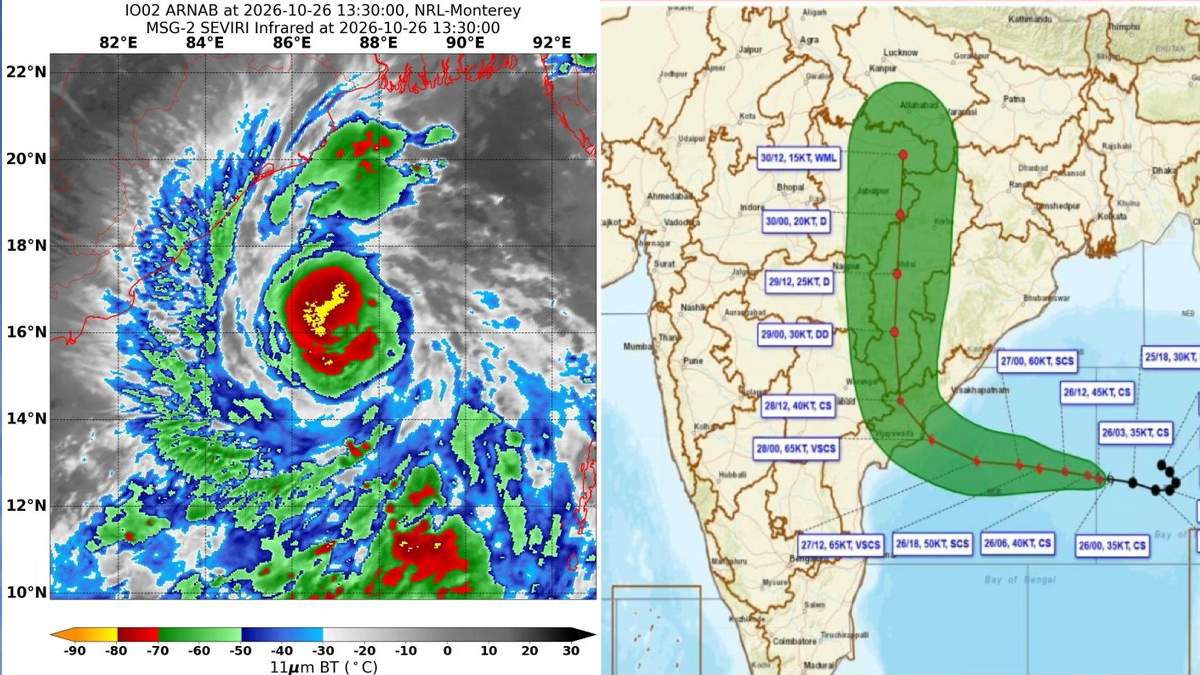
The India Meteorological Department (IMD) has warned of unseasonal rainfall, thunderstorms and strong winds in parts of the state over the next week, and the weather system could bring heavy rainfall to eastern, central and southern parts of the state after it has moved inland. The weather system in Uttar Pradesh is expected to produce heavy rainfall, and the Uttar Pradesh government has taken notice.
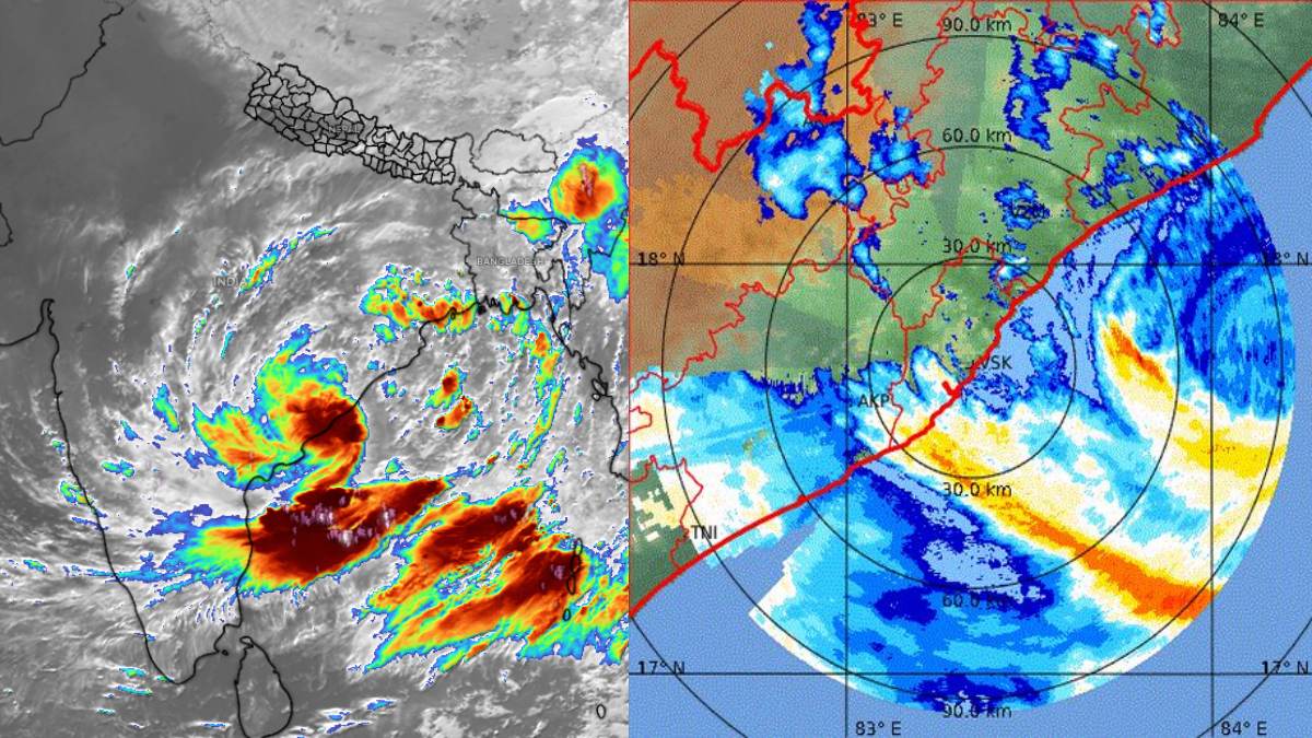
According to the forecast, the cyclone will cross the Andhra Pradesh and Yanam coasts between Bapatla and Visakhapatnam early on October 28. The associated weather system will move inland after landfall, and weather conditions in many parts of central India and the Gangetic plains will be affected.
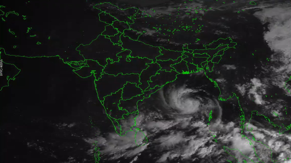

The IMD has predicted that eastern Uttar Pradesh could experience heavy rainfall, with isolated extremely heavy rainfall on October 29. Heavy to very heavy rainfall is also likely in parts of eastern Uttar Pradesh on October 30. However, the distribution and intensity of rainfall will depend on the movement of the system after landfall and officials are expected to provide a more detailed district-wise forecast as the situation develops.
IMD Yellow Alert for Seven Districts on October 28
A yellow alert has been issued for Sonbhadra, Mirzapur, Chandauli, Varanasi, Bhadohi, Ghazipur and Ballia on October 28. Winds are expected to be 30-40 kilometres per hour in these districts, according to the forecast. Residents living in these areas should be aware of the weather and take precautions in preparation for thunderstorms and other weather.
On October 29, there is an orange alert warning of heavy rainfall and strong winds in parts of Uttar Pradesh. Districts that will be affected include Chitrakoot, Kaushambi, Prayagraj, Fatehpur, Pratapgarh, Rae Bareli, Amethi and Sultanpur. In the affected regions, wind speed could be 40-50 kilometres per hour. It could affect road travel and outdoor activities as well as agricultural activities in areas where heavy rains for a short time are experienced.

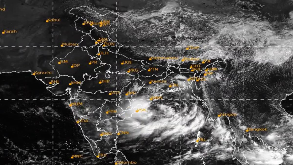
More rain is expected in Eastern UP and the Terai region
The weather impact could extend beyond the districts covered by the initial alerts. Heavy rain and strong winds will be experienced on October 30 in Bareilly, Pilibhit and Shahjahanpur, and some districts of Purvanchal, Awadh and Terai. Daytime temperatures could fall by about 5 to 8 degrees Celsius in affected areas as rainfall and cloud cover increase, the forecast also indicates.
A sudden drop in temperature may be welcomed relief from warmer daytime conditions, and thunderstorms and strong winds may give rise to localised risks. Waterlogging, reduced visibility, falling branches and roadway damage are some of the risks during heavy rain. The actual effect will vary by district, and residents shouldn’t assume that all parts of Uttar Pradesh will experience the same weather conditions.
Uttar Pradesh Government Steps Up Preparedness
The Uttar Pradesh government, headed by Chief Minister Yogi Adityanath, has put the administration on alert regarding weather changes. The relief commissioner’s office has issued safety precautions for the public and farmers, and the government is also prepared for weather-related disruptions.
Residents should shelter in well-built buildings during thunderstorms and avoid standing in the vicinity of trees, electricity poles or weak structures during strong winds. People should also avoid unnecessary travel during storms and stay away from open fields, agricultural land and water bodies during lightning. Farmers need to protect harvested crops and agricultural produce from rain and move livestock to safer locations when necessary.
Officials have also advised residents to follow updates from the IMD, local administration and the Sachet disaster-alert platform. Such information can be of great value if warnings are updated or extended to other areas.
Will Lucknow be affected by Cyclone Arnab?
Lucknow might also experience weather changes as the system moves inland. Rain could hit the state capital between Thursday and Saturday (October 29–31), weather reports indicate. But the intensity and timing of the rainfall in Lucknow will depend on the cyclone's movement and the development of its associated circulation after landfall.
Residents should keep track of the latest forecasts instead of broad statewide predictions. Even if rainfall is intermittent, thunderstorms and strong winds can pose dangers, especially during outdoor travel and evening commutes.
What Residents Should Do
In light of warnings of heavy rainfall and strong winds in several districts, residents should secure loose objects around their homes, avoid flooded roads and stay away from damaged electrical infrastructure. Farmers should protect crops and stored produce, and commuters should allow additional travel time if heavy rain reduces visibility or affects road conditions.
Cyclone Arnab is expected to have its most direct impact along the Andhra Pradesh coast, but its wider weather effects could extend to Uttar Pradesh after landfall. In the coming days, we’ll see how much rainfall the state receives and which districts experience the strongest conditions. Residents are advised to follow the latest official IMD bulletins and local administration instructions through October 31.







Comments