China’s ambitious plan to build the world’s largest hydropower project on the Yarlung Tsangpo River has come under renewed scrutiny after researchers linked to the country’s own geological establishment identified an active fault running through the proposed construction corridor.
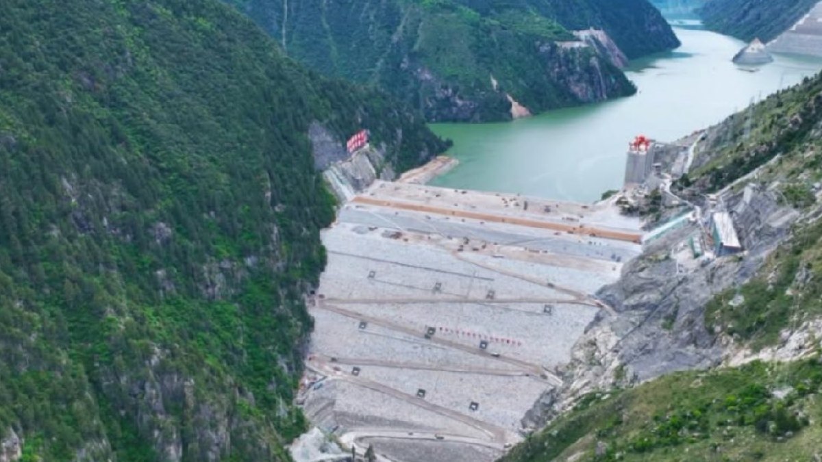
The results raised new questions about the geological challenges faced by the massive infrastructure project that officially began in Tibet in July 2025. Estimated to cost around 1.2 trillion yuan (about $168 billion), the project is one of China’s biggest infrastructure investments.
The development will consist of five hydropower stations connected along the Yarlung Tsangpo River. Beijing has described the project as a major renewable energy project that will generate electricity and contribute to development in western China. But an active geological fault in the construction zone could complicate the engineering and safety issues.
China’s own researchers identify active fault
A study published in Sedimentary Geology and Tethyan Geology in June 2026 identified the Paizhen Fault as an active geological structure that is passing through the project corridor. The research was carried out under the supervision of the China Geological Survey.
The fault has been active since the Pleistocene epoch and has experienced repeated geological movement over time, the researchers said. It has fractured rock formations around it, and the cohesion in some areas has weakened, and the geological conditions are unstable.
The findings are especially significant because the assessment comes from Chinese geological researchers rather than foreign critics of the project.
Scientists say the fractured rock might make the construction of tunnels, reservoirs, roads and other key infrastructure in the hydropower complex more difficult. Continuous geological monitoring and extensive reinforcement of vulnerable slopes along the construction and operational phases of the project were recommended, the report said.
Why the Geological Location Is Significant
The project is located in the Eastern Himalayan Syntaxis, one of the most tectonically active areas on the planet. The area is located in a region in which Indian and Eurasian tectonic plates continue to collide and thus is under strong geological pressure.
The area has steep mountain terrain, deep river gorges, active faults, frequent landslides and significant seismic activity, according to experts. The enormous weight of reservoir water has also been warned that it could create pressure in fractured rocks.
Water in already weakened geological formations could lead to an increase in pore-water pressure and thus potentially destabilise slopes around reservoirs, researchers said.
The history of earthquakes in the region is also illustrative of these issues. The 1950 Assam-Tibet earthquake, which was 8.6 in magnitude, is still one of the strongest earthquakes ever recorded. In the area, the 6.9 magnitude Milin earthquake in 2017 and the 6.8 magnitude Tibet earthquake in January 2025 have also killed more than 100 people and damaged infrastructure such as reservoirs.
Landslides may be further hazards
Earthquakes are not the only danger. The Yarlung Tsangpo Grand Canyon is also vulnerable to major landslides. A huge amount of rock falling into a reservoir would generate strong displacement waves and put mighty pressure on dam structures.
The five-station cascade design has also raised questions about possible cascading failures. If an upstream reservoir or hydropower station were to suffer a major failure, enormous volumes of water could move downstream quickly, adding pressure on lower facilities.
The narrow and steep Himalayan valleys could also leave downstream communities with limited warning time in the event of an emergency water release or major dam breach.
Concerns for India and Bangladesh
The project has great implications beyond China. The Yarlung Tsangpo becomes the Siang River after entering Arunachal Pradesh and later forms the Brahmaputra as it flows through Assam before reaching Bangladesh.
Any major change in river flows, sudden water releases or structural failure could therefore have consequences for millions of people living downstream.
India and Bangladesh have previously expressed concern about upstream developments, including dry-season water flows, sudden flooding, water security and the need for greater data sharing between countries that depend on the river system.
Transparency remains a major concern
Although the project is vast, a lot of aspects are still not publicly available such as detailed dam-break modeling, detailed seismic hazard assessments, emergency response plans and real-time hydrological information sharing.
The lack of public information has increased the concern of downstream countries and experts who argue that such a significant project on a transboundary river needs to be more transparent.
On top of its energy interests, the project also has a strategic context as the Yarlung Tsangpo flows through a region close to the Line of Actual Control between India and China.
While Beijing has claimed the project is for clean energy generation and regional development, an active fault in the construction corridor has raised the stakes on the long-term safety, environmental impact and potential impact on downstream nations.