A deep depression over the Bay of Bengal crossed the Andhra Pradesh coast near Kalingapatnam in Srikakulam district between Wednesday night and the early hours of Thursday, September 24, according to the India Meteorological Department (IMD).
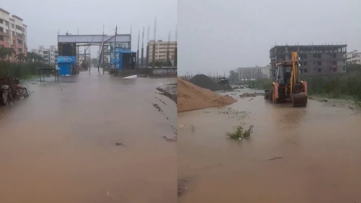
The weather system moved west-northwest toward north Andhra Pradesh and coastal south Odisha before landfall. The IMD said the system crossed the coast close to Kalingapatnam between 11 pm on Wednesday and 1 am on Thursday.
The system remained a deep depression as it moved along the coast. It had earlier been over the west-central and adjoining northwest Bay of Bengal and had been moving towards the coast at a relatively slow pace.
The landfall brought the system over land, but its effects are expected to continue, especially heavy rainfall across parts of Andhra Pradesh, Odisha and neighbouring states.
Heavy Rain Expected after landfall.
After crossing the coast, the deep depression is expected to bring heavy rainfall to eastern and central India.
The weather system had already brought heavy to extremely heavy rainfall to some parts of Andhra Pradesh and Odisha before landfall. In Odisha, some places were experiencing intense rainfall, and trees fell, and roads were blocked in parts of Ganjam and Gajapati districts. Water levels were also rising in some rivers including Rushikulya, Bada Nadi and Loharakhandi.
North Coastal Andhra Pradesh remained under close watch as the system approached the coast. State disaster management authorities had warned of isolated heavy rainfall in districts like Srikakulam, Vizianagaram, Parvathipuram Manyam, Alluri Sitharama Raju, Polavaram, Visakhapatnam, Anakapalli and Kakinada.
The weather system will also affect Telangana as it moves inland. It is expected to experience widespread rainfall across Telangana, with heavy to very heavy rain in some places, the India Meteorological Department has predicted.
Strong Winds And Rough Seas
The deep depression also came with strong winds and rough sea conditions along the coast.
Vijayawada 144 mm today.
— Naveen Reddy (@navin_ankampali) September 24, 2026
Slowly deficit wiping out over coastal AP. pic.twitter.com/n640UIdGLk
Before landfall, the IMD had warned of squally winds of around 30 to 35 knots, gusting up to 40 knots, along the North Andhra coast. Sea conditions were expected to remain rough to very rough.
As the system moved towards the coast, authorities advised fishermen to stay away from the sea. Port authorities had also kept cautionary signals at several ports along the Andhra coast, such as Kalingapatnam, Bheemunipatnam, Visakhapatnam, Gangavaram and Kakinada.
The combination of heavy rainfall and strong winds can result in waterlogging, flash flooding, fallen trees, and road and other infrastructure disruption in vulnerable areas.
The system is expected to weaken gradually.
The deep depression is expected to gradually weaken as it moves further inland.
The system is expected to continue to move northwest after landfall and maintain deep depression intensity for a short period of time. The interaction with land is expected to weaken the system gradually over the next few days.
Weather agencies are monitoring rainfall along the system’s expected path. Areas of the coastline away from the immediate landfall point can also experience heavy rainfall as the system moves inland.
The main concern after landfall is rainfall rather than further intensification over the sea. The system did not make landfall as a cyclonic storm and remained classified as a deep depression by the IMD.
Authorities Remain On Alert
Andhra Pradesh authorities had stepped up preparedness in vulnerable districts before the system reached the coast.
The state disaster management authorities had ordered district administrations to keep close monitoring, especially in North Andhra. Disaster response teams were also placed in areas of risk for flooding, waterlogging, and other weather-related disasters.
Schools in several affected districts had also closed as a precaution ahead of the system’s arrival, and officials monitored low-lying areas and rainfall conditions.
The public should follow official weather alerts and avoid unnecessary travel through areas where flooding or landslides are likely to occur.
Now with the deep depression over land, the focus will turn to its movement inland and the rainfall it is expected to bring over Andhra Pradesh, Telangana, Odisha and other parts of central and eastern India over the next few days.
The IMD and state disaster management authorities are still monitoring the system and its effects as it weakens after landfall.