The Punjab government plans to use drones for real-time monitoring of stubble burning as it prepares for the upcoming paddy harvesting season. The idea is to improve surveillance and farm fire detection, particularly for fires not detected by currently available satellite monitoring systems.
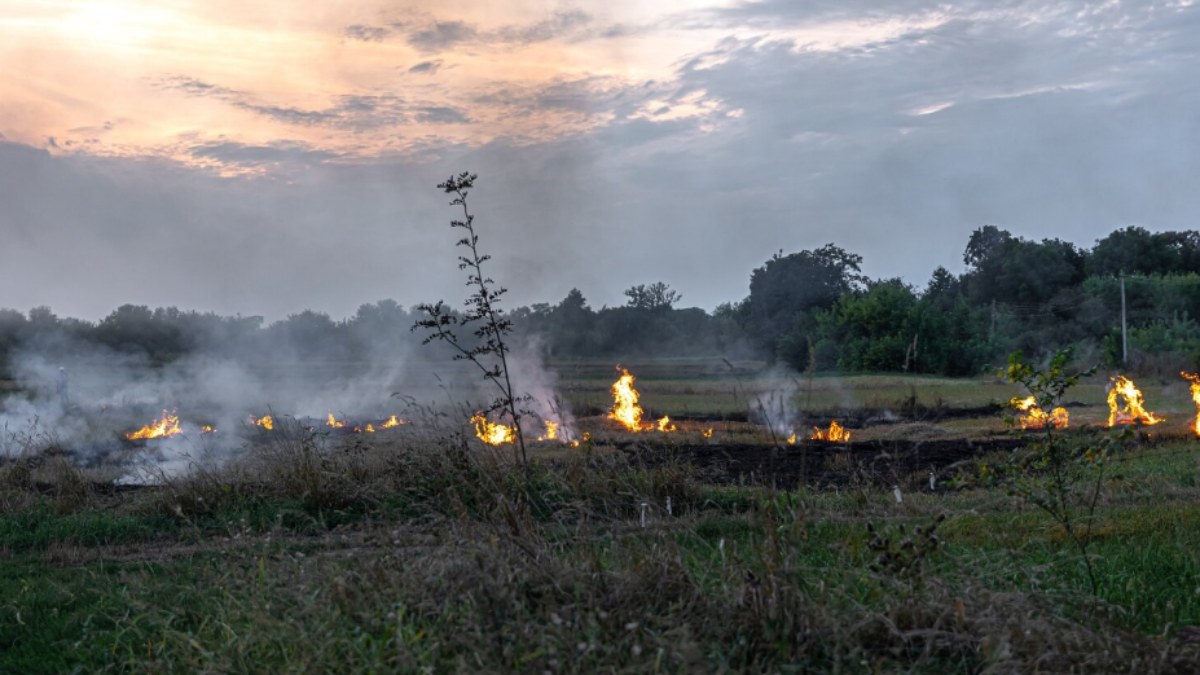
The decision follows the direction from the Commission for Air Quality Management (CAQM) that Punjab needed to improve its monitoring system in areas of stubble burning. Unmanned aerial vehicles could also help to detect fires more quickly and to bring on-ground forces to respond to the situation while incidents are still going on.
Punjab’s current monitoring system relies primarily on satellite observations through the Punjab Remote Sensing Centre. But officials say satellites do not always monitor the same locations, and short-duration or late-evening fires cannot be captured.
Drones to Focus On High-Risk Areas And Late-Evening Fires
According to officials, the new drone-based system will focus initially on areas identified as stubble-burning hotspots. A detailed operational plan and standard operating procedure will be built up for how the drones will be deployed and how aerial surveillance data will be shared with district authorities.
The CAQM has specifically mentioned late-evening crop-residue burning as a monitoring problem. Some farm fires occur after satellite passes, and they are difficult to detect through the existing system, the agency has said.
The proposed drone surveillance will focus on the afternoon and evening period, particularly from 3 pm to 9 pm. Drones can take pictures, videos, and GPS-based location information to help enforcement teams to locate the impacted fields and take action quickly.
The CAQM’s direction came after a pilot project was conducted in Patiala earlier this year. According to officials from the New Indian Express, the trial exhibited clear aerial images and helped authorities to guide them to locate farm fire locations. The experience led to the development of drone deployments in Punjab and Haryana.
The exact number of drones required, the deployment structure, and technical specifications are still being worked out. The initial plan is to use them mainly in hotspots and to expand the system in response to the effectiveness and need of the system.
Punjab reported a decline in farm fires.
The drone program comes at a time of decline in stubble burning incidents in Punjab, as the number of stubble burning incidents has declined, which is the result of the drone program. During the 2025 paddy harvesting season, from September 15 to November 30, the state registered 5,114 farm-fire incidents, compared with 10,909 incidents during the same period in 2024.
Despite the decline, authorities are preparing for another tough harvest season. Paddy harvesting will pick up in late September and October, and the amount of crop residue to be managed will increase.
On September 15, the first day of the official 2026 monitoring season, two farm-fire incidents were reported in Tarn Taran district, according to official sources in the media. The annual monitoring period lasts from September 15 to November 30.
The state government has also invested in crop-residue management machinery. Punjab has spent over Rs 300 crore on such equipment under the centrally sponsored Crop Residue Management Scheme, says the Hindustan Times. Information, education, and communication efforts to encourage farmers to switch to alternatives to burning activities have been allocated Rs 26.31 crore.
Satellite Monitoring To Be Strengthened With Ground Action
Satellite-based monitoring will continue to be central to monitoring agricultural fires. The Union government has previously indicated that its monitoring system uses satellite data to identify active fire locations and assess burnt areas, and sends information to field officials for action.
However, authorities have been increasing the speed and precision of detection. Satellite information can reach authorities after a delay, and satellites make only a limited number of observations during their passes, the CAQM told us in July. Drones can be used when and where surveillance is needed, enabling the authorities to get location-specific visual evidence.
The move comes as concerns arise over the usefulness of only satellite-generated fire counts. Satellite observations can miss fires outside their observation window, especially when fires are short-lived or occur later in the day, and satellites may be unable to detect them.
Punjab's drone programme is therefore intended to complement (and not replace) existing satellite surveillance. By harnessing aerial monitoring, satellite data, and ground-level enforcement, officials will be able to obtain better information about crop-residue burning during the forthcoming paddy harvesting season.
With harvesting expected to pick up from October, the effectiveness of the new drone-based system will be closely watched as Punjab will have to fight more farm fires and improve its response to stubble burning as part of Punjab’s strategy.