
The Indian Space Research Organisation (ISRO) is preparing to launch its navigation satellite NVS-03 on 30 October 2026 in order to strengthen India’s indigenous satellite navigation system Navigation with Indian Constellation (NavIC).
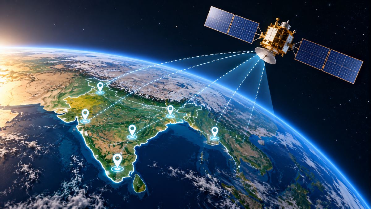
The satellite will be carried by GSLV-F18 rocket from Satish Dhawan Space Centre Sriharikota Andhra Pradesh at 11:51 PM IST.
The mission comes at a bad time for NavIC as it has had several technical setbacks with its satellites and onboard atomic clocks. Fewer operational satellites are available for positioning services so India has been using a weaker version of its home grown navigation network.
NVS-03 will help restore and strengthen the system from transportation and maritime navigation to defence and disaster management. Applications include transportation and maritime navigation; defence and disaster management; etc.
What Is NavIC and Why Did India Develop It?
NavIC (formerly Indian Regional Navigation Satellite System – IRNSS) is India’s independent satellite-based navigation system developed by ISRO.
It was intended to reduce India’s dependence on foreign navigation services (mainly the United States operated Global Positioning System GPS).
NavIC was developed after Kargil conflict (1999) when India couldn’t access foreign satellite navigation information for military purposes.
The system was designed to provide positioning, navigation and timing services throughout India as well as an area beyond its boundaries (1500 kilometres).
NavIC provides two types of services:
- Standard Positioning Service: This is for civilian use and serves applications such as vehicle navigation, transportation, location-based services and maritime operations.
- Restricted Service: An encrypted service for authorised users (strategic and defence applications).
Unlike GPS which covers the whole world, NavIC is primarily a regional navigation system (for India and its surrounding region).
How Does NavIC Work?
Satellite navigation systems determine where a receiver is by measuring the time it takes signals from several satellites to arrive at the receiver.
Each navigation satellite transmits continuously signals containing information about its position and the time at which it transmitted them.
A receiver (such as one in a navigation device, smartphone or vehicle tracking system) compatible with the signal is then able to work out how long those signals took to arrive; using signals from several satellites it estimates its distance from each satellite and calculates its location.
Timing is critical to this process: A small error in the clock of the satellite will change the calculated distance and reduce positioning accuracy.
This is why atomic clocks are some of the most important parts of navigation satellites: they maintain extremely precise time references so receivers can calculate their positions correctly.
NavIC uses a combination of geostationary and geosynchronous satellites to maintain coverage over the intended service region.
Why Has NavIC Faced Technical Setbacks?
Although NavIC is strategically important it has had several technical problems since its development.
India had planned a seven-satellite constellation to provide continuous regional navigation services but onboard atomic clocks and satellite propulsion systems have failed. The availability of the network has been affected.
Several first-generation satellites had problems with imported atomic clocks the clocks that keep navigation signals in time.
In March 2026 the atomic clock aboard IRNSS-1F satellite stopped working. The satellite could still support some one way broadcast messaging applications but it could no longer provide positioning, navigation and timing services.
The loss reduced the number of operational satellites available for independent NavIC positioning.
Another big setback was NVS-02 which was launched in January 2025. The satellite reached its transfer orbit but could not be manoeuvred into its intended operational orbit because of a technical problem with its propulsion system.
An issue with the drive signal to an oxidiser-line pyro valve was found during orbit raising.
These setbacks showed that maintaining a satellite navigation network is not easy and that both onboard components and operational systems needed to be improved.
What Is Special About the NVS-03 Satellite?
NVS-03 is from the second generation of India’s navigation satellites. It is the third satellite in the NVS series and will strengthen the NavIC infrastructure.
One of its important features is the inclusion of an indigenous atomic clock with procured atomic clocks.
Domestic timing technology development is important because it can reduce dependence on imported components and strengthen India’s ability to maintain its navigation infrastructure.
NVS-03 will also add the L1 frequency band to the L5 and S frequency bands used by NavIC.
The addition of L1 will make NavIC more compatible with navigation receivers and enable wider integration of NavIC into civilian devices.
The satellite will be placed in a Geosynchronous Transfer Orbit by the GSLV-F18 rocket. It needs to reach its operational orbit and complete testing and commissioning before it can provide navigation services.
Why Is the NVS-03 Mission Important for India?
A reliable indigenous navigation system has civilian and strategic applications.
- Railway tracking: NavIC can support real-time tracking of trains to improve railway operations and safety. A larger operational constellation could strengthen the government’s plans for satellite-based train tracking expansion.
- Road transportation: Navigation signals can be used for vehicle tracking, fleet management and location-based services.
- Maritime navigation: Fishing boats, boats and ships can use satellite navigation to locate themselves and plan routes (particularly relevant for coastal communities and maritime operations).
- Defence applications: independent navigation capability is needed for military operations where access to foreign navigation systems cannot always be guaranteed.
- Disaster management: Precise positioning information can help emergency response teams, rescue operations and coordination of relief activities.
- Aviation and infrastructure: Satellite timing and positioning can support applications in transportation and other critical infrastructure sectors.
What Comes Next for India's NavIC Programme?
NVS-03 is one of a planned series of five second generation navigation satellites to improve reliability and continuity of NavIC services.
The next satellites NVS-04 and NVS-05 are also expected to bolster the constellation.
The immediate priority is to launch NVS-03 successfully, put it into orbit and complete commissioning. A successful launch does not mean that the satellite will be operational immediately.
India’s experience with NavIC shows that building a satellite navigation system is not just about launching spacecraft. It also requires reliable atomic clocks, dependable propulsion systems, continuous monitoring and sufficient number of operational satellites.
With NVS-03 mission ISRO is another step closer to strengthening India’s independent navigation capabilities and reducing dependence on foreign satellite navigation networks.






Comments