
Trudy quickly developed into a Category 3 major hurricane on Mexico’s Pacific coast, raising fears of strong winds, heavy rains and coastal inundation. The storm strengthened on Friday, October 16, 2026, with wind gusts of about 195 kilometres/hour (120 mph) of the storm at its peak, according to the US National Hurricane Centre.
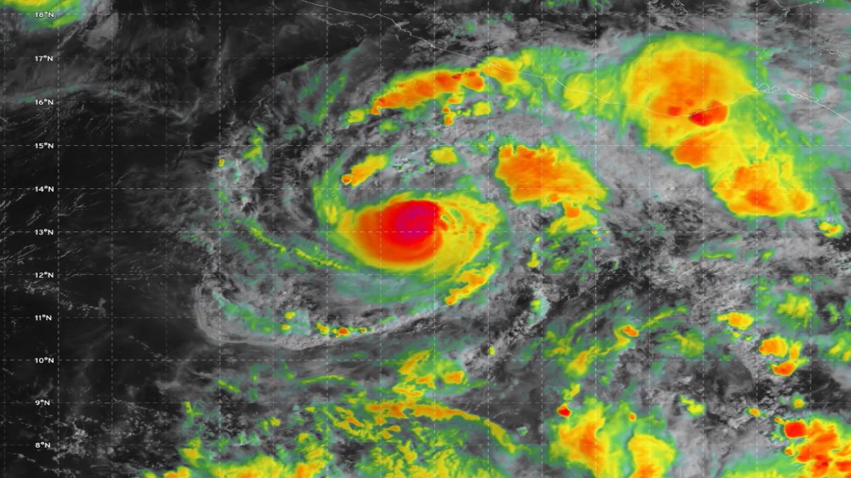
Trudy had been moving northwest at approximately 9 kilometres/hour and was about 420 kilometres southwest of Acapulco and about 590 kilometres south-southeast of Manzanillo. The hurricane could strengthen further over the next few days and put officials and communities along the southwestern and western coast of Mexico on alert, according to forecasters.
The hurricane is now a Category 3 hurricane on the Saffir-Simpson Hurricane Wind Scale, and sustained winds can cause great damage to buildings, trees and infrastructure and can cause road accidents. The hurricane can also cut off power to homes and damage roofs and road access to people, and strong winds can also spoil power and cause damage to everything from homes and businesses in the region or roads and damages to roads.
Though Trudy has been offshore, it was at sea at the time of the most recent news reports, and its approach to the coast meant that residents and local authorities needed to prepare for changing conditions. This will depend on the hurricane's track at its end, its strength and how close it is to land.
Heavy rainfall is a major concern of the storm. Torrential downpours can overwhelm drainage systems, trigger flash floods and cause rivers and streams to rise faster than expected. Long periods of heavy rainfall can also cause landslides and mudslides in mountainous areas with steep terrain.
These risks can also be a serious threat to communities even while the centre of a storm remains offshore. Coastal areas may also face dangerous waves, high surf and hazardous sea conditions along the coastline. People living in vulnerable areas, particularly around rivers, hillsides and low-lying coastal areas, should be aware of the weather warnings and follow advice from local emergency authorities.
The Mexican authorities and weather officials are closely watching Trudy as it approaches the region. A hurricane watch was issued for a portion of the Mexican coast from Punta San Telmo north to Cabo Corrientes on Friday, according to the U.S. National Hurricane Centre. A hurricane watch means that hurricane conditions are likely to be present in the given area and may be in place within a few days, usually within 48 hours. Residents should not interpret a watch as an indication that the storm is coming down in that area.
Trudy is not the only weather system being monitored in the Pacific. Tropical Storm Simon, north of Trudy, had high sustained winds of about 75 kilometres per hour and was expected to fade into a remnant low. Tropical Storm Champi was moving west-northwest to the east of Guam with winds at around 86 kilometres per hour.
A typhoon warning was issued for Guam and Rota and tropical storm warnings for Tinian, Saipan and nearby areas. The presence of several tropical systems at once demonstrates the need for continuous monitoring of the Pacific, but each is moving in a different direction and has different potential impacts.
As Hurricane Trudy continues to move through the eastern Pacific, its next moves will be crucial to determine the extent of danger on Mexico’s southwestern and west-central coast. The centre of the storm was expected to be closest to the coastline late on Saturday, October 17, and further strengthening remained possible, forecasters said.
Residents and travellers should be guided by the National Hurricane Centre and Mexican emergency workers and not social media posts. People should follow local safety instructions, stay away from dangerous coastal waters, and prepare for disruptions to transport, power, and daily life. The next few days will be crucial as meteorologists hone the forecast and experts assess the prospect of landfall, flooding and wind damage.






Comments
Leave a Comment