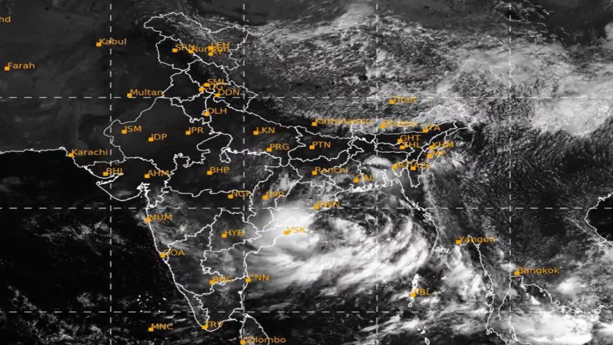
Karnataka will continue to experience a lot of rainfall and thunderstorms in the next few days as a deep depression that developed over the Bay of Bengal has moved inland after crossing the north Andhra Pradesh coast. Andhra Pradesh and Odisha are on the receiving end of the weather system, which is also affecting parts of Karnataka, and they have already started to see heavy rains and thunderstorms, according to the India Meteorological Department (IMD), which has been issuing rain and thunderstorm warnings in parts of the state.

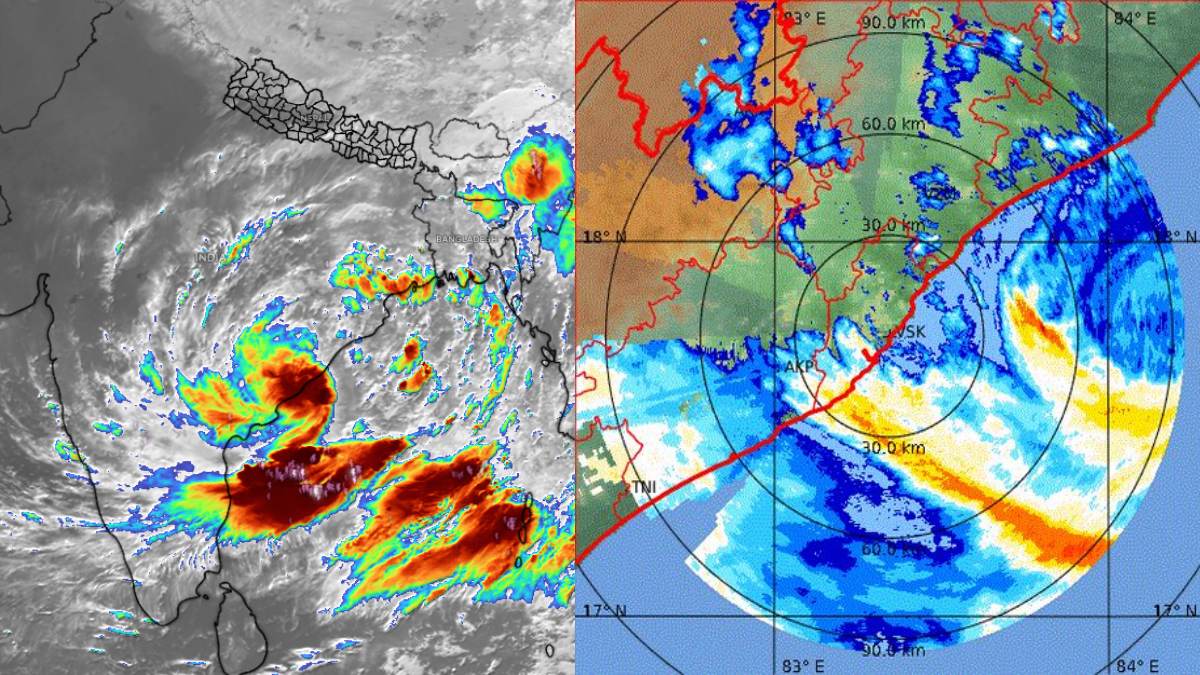
The latest IMD information indicates that the system crossed the north Andhra Pradesh coast close to southwest of Kalingapatnam between late Wednesday night and early Thursday morning. At the time of landfall, the deep depression was accompanied by winds of 55-65 kmph and gusts up to 75 kmph. The system is now moving inland towards the northwest and is expected to gradually weaken.
According to the Bengaluru Meteorological Centre, Coastal Karnataka, North Interior Karnataka, and South Interior Karnataka have been put under weather warnings for September 24 and 25. Coastal Karnataka has a heavy-rain warning for September 24, while thunderstorm and lightning activity is expected on September 25. North Interior and South Interior Karnataka are also under heavy rain and thunderstorm warnings for the same period.
The impact will be particularly pronounced in coastal Karnataka and the Malnad region. Udupi, Dakshina Kannada, and Uttara Kannada might experience heavy rain and thunderstorms and lightning at times. Residents in vulnerable and low-lying areas should be watchful, especially during heavy rainfall and wind-driven storms and strong gusty winds, the government has said.
Bengaluru and some South Interior Karnataka districts may also experience rain. Bengaluru Urban, Bengaluru Rural, Chikkaballapur, Kolar, Tumakuru, Chitradurga, Davanagere, and Vijayanagara are expected to see partly cloudy conditions with some areas of moderate rainfall and thunderstorms. Weather conditions can change quickly, especially in the afternoon and evening.
Parts of North Interior Karnataka will also experience rainfall. Bagalkot, Vijayapura, Yadgir, Ballari, Dharwad, and Gadag may be among the districts that see thunderstorms and rain, with heavy rain in a few cases. The intensity can also vary from district to district, and residents are advised to follow local IMD updates and not rely on broad statewide forecasts.
The situation is more acute in Odisha and Andhra Pradesh. The IMD has warned of extremely heavy rainfall in parts of Odisha on September 24, with very heavy rain expected in subsequent days. The deep depression is expected to slowly weaken as it moves inland, but its circulation can still generate significant rainfall even after landfall.
In fact, we may refer to the current system as a deep depression, not an active cyclone. The IMD had indicated that the system was not expected to intensify into a cyclone before it came to the coast, and its latest updates indicate a gradual weakening after landfall. In light of this, reports of "Cyclone Arnab" should be considered carefully when describing the current meteorological state.
For Karnataka, the weather system will continue to bring rain and thunderstorms, but the most significant impacts will be closer to the system’s track over Andhra Pradesh, Odisha, and nearby central Indian regions. Residents should, however, be alert during thunderstorms, stay away from trees or unstable structures, and avoid open areas during lightning activity.
Fishermen in the affected coastal areas should also be warned to heed official marine warnings and to avoid going into unsafe sea conditions. People living near streams, rivers, and other places prone to flooding should be very wary if rainfall becomes heavy and avoid the water.
With the IMD warning of rain for Karnataka for the next couple of days, residents of Bengaluru, coastal Karnataka, Malnad, and parts of the interior districts can expect unsettled weather. Local disaster teams are monitoring the situation, and further forecasts will depend on how fast the deep depression weakens as it moves inland.