The weather conditions on the Odisha-Andhra Pradesh coast are now under close watch for a depression in the west-central and adjoining northwest Bay of Bengal. The India Meteorological Department (IMD) said it expects the system to develop into a deep depression within a few hours and move towards the north Andhra Pradesh-South Odisha coast.
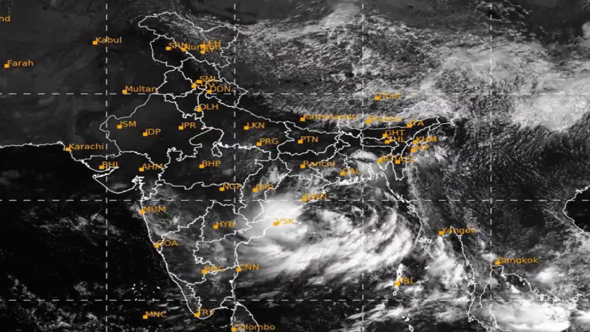
The developing system has also raised speculation about the formation of Cyclone Arnab. However, the current system is not officially classified as a cyclonic storm. According to the cyclone naming roster, Arnab is the next cyclonic storm to form over the North Indian Ocean. The name is contributed by Bangladesh and means "ocean" in Bengali.
According to the latest IMD update, the depression moved west at a speed of around 18 kmph during the six hours before the morning observation on September 22. At 8:30 am, it was centred over the west-central and the northwest Bay of Bengal around latitude 17.9°N and longitude 86.0°E. It was approximately 200 km southeast of Gopalpur in Odisha, 200 km east-southeast of Kalingapatnam in Andhra Pradesh, 210 km south of Puri and 290 km east of Visakhapatnam.
The IMD forecasts that the system will move west-northwestward and intensify into a deep depression over the west-central and adjoining northwest Bay of Bengal. It is then expected to cross the northern Andhra Pradesh-South Odisha coast between Visakhapatnam and Gopalpur during the night of September 23 and the early hours of September 24. This means that the coastal belt could experience difficult weather conditions over the next few days.
The weather system has already begun affecting Odisha, with heavy rainfall reported in coastal and southern parts of the state. Some areas could see very heavy rainfall, with isolated locations recording rainfall up to 20 cm, IMD said. Squally winds of 55-65 kmph are expected as well, adding to waterlogging, fallen trees and disruption in vulnerable areas.
Satellite animation of #Depression over Westcentral & adjoining Northwest Bay of Bengal pic.twitter.com/OyAVTphcgr
— India Meteorological Department (@Indiametdept) September 22, 2026
Odisha authorities are taking precautions as the system approaches the coast. Schools and Anganwadi centres in several districts have been closed because of the heavy rainfall forecast. Khurda, Jagatsinghpur, Ganjam and Gajapati were among those districts where schools were shut down, while Malkangiri announced school closure through September 24. Teachers and other staff have been asked to be available in some areas so that school buildings can be used if emergency arrangements are needed.
The Odisha government has also stepped up preparedness in coastal and southern districts. Officials have been instructed to prepare cyclone and flood shelters, and personnel and machinery have been placed at strategic locations. Fishermen are advised not to venture into the sea until September 24, and those already at sea have been ordered to return to shore.
The IMD has also warned of flooding in low-lying areas that will experience heavy rainfall, particularly in areas already hit hard. Rising river levels could be an additional risk in these vulnerable zones. Therefore, water levels as well as the depression's movement are closely monitored by authorities.
For now, the weather system is being tracked as a depression that is expected to develop into a deep depression rather than an officially declared cyclone. If it becomes cyclonic-storm-force strong, the name under the regional naming system would be Arnab. Residents in Odisha and Andhra Pradesh are being advised to follow official weather alerts and local administration instructions.
The next 24 to 48 hours will be important as the system moves closer to the coast. Heavy rainfall, strong winds and floodwaters are expected in Odisha and north Andhra Pradesh, so preparations are underway ahead of the forecast landfall between Visakhapatnam and Gopalpur.