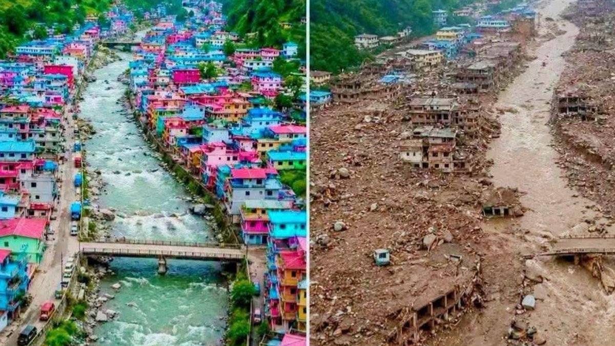
Deeply disturbing satellite images of the devastating flood that recently struck Nepal's Lhende River basin have shed new light on the recent flood, as it appears the disaster was triggered by a massive snow-rock landslide near the Nepal-China border. The flood, based on initial analysis from Planet Labs observations, is glacier-inclusive and therefore is heightening dangers from unstable mountain terrain and climate-related hazards in the Himalayan region.
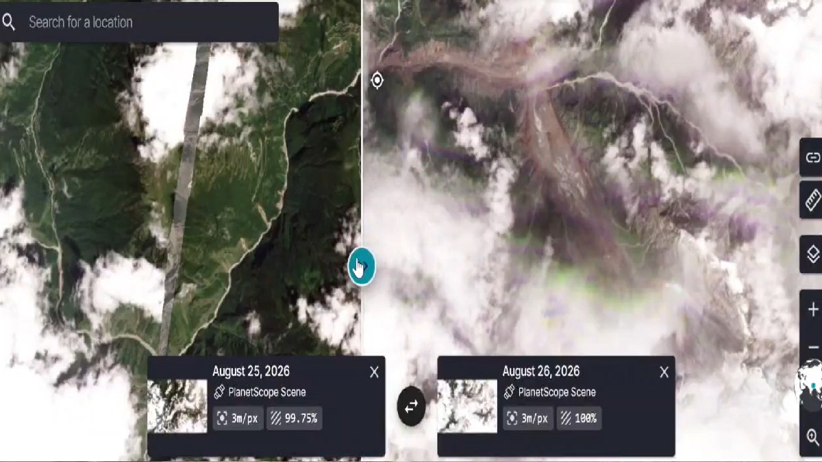
The landslide reportedly took place about 20 kilometres northeast of the Rasuwagadhi border crossing that forms a critical trade route between Nepal and China. Satellite images showed that snow, rock, and ice fell from a mountain slope and fell into the river system, and experts said it created such a torrent of water, debris, and sediment that even the poorest people in the area could not escape.
Researchers looking at the images observed that the landslide might have temporarily blocked part of the river but then released a massive amount of water. When a landslide occurs in a mountainous area, it’s likely that it will form natural dams that eventually burst, resulting in dangerous floods without warning. The glacial ice in the landslide material is so much so that scientists have classified it as a glacier-inclusive flood, since this sort of event is more common in the Himalayas.
The flood affected areas along the Lhende River that feeds into larger river systems throughout Nepal. Roads, bridges, hydropower facilities, and settlements in the vicinity of riverbanks have been damaged, officials said. Rescue and assessment teams are still monitoring the situation as water levels change and additional landslides or secondary flooding occur.
The disaster has revived interest in the vulnerability of Himalayan areas to climate-related threats. As temperatures increase, glacier melt across the mountain range increases the chances of forming glacial lakes, unstable ice masses, and slope failure. Engineers say that warming can reduce the stability of mountain structures by melting the ice that holds rocks together and making landslides more frequent and severe.

Planet Labs को स्याटेलाइट तस्बिरको विश्लेषणका आधारमा गरिएको प्रारम्भिक अध्ययनबाट नेपाल-चीन रसुवागढी नाकाबाट करिब २० किलोमिटर उत्तरपूर्व नेपाल-चीन सिमानामा गएको हिम-चट्टान पहिरोका कारण ल्हेन्दे खोलामा गेग्य्रानसहितको बाढी आएको देखिएको छ। pic.twitter.com/kCAo9O1Zb0
— NDRRMA (@NDRRMA_Nepal) August 26, 2026
Experts say that the combination of snow, rock, and glacial soil and snow-and-glacial material from the landslide significantly enhanced the flood's intensity. A sudden release of debris and water can produce a torrent of damaging flows with tons of massive boulders, trees torn apart, and infrastructure destroyed in its path.
Satellite technology has been key in understanding the incident. High-resolution images from Planet Labs have allowed us to identify the likely source of the landslide (and how that landslide changed the landscape) and track how it has changed. The observations are helping authorities to know what is still ongoing and how to manage to protect downstream communities from further harm.
Nepal has been on high alert since the flooding began. Government agencies, disaster management, and scientific institutions are working with disaster management authorities and experts to assess the extent of the damage and determine if there are still risks in the area. Citizens living near rivers and low-lying areas of Nepal and other low-lying areas have been told to be on high alert, and safety instructions have been communicated.
The incident also highlights the rising importance of cross-border cooperation between Nepal and China on monitoring natural disasters in the Himalayas. Since rivers and mountain systems cross national borders and satellite data, weather data, and hazard assessments can be communicated promptly to improve disaster preparedness and response efforts, it is likely that the information should be shared between Nepal and China to provide better guidance and help to improve disaster management.
The flood is a stark reminder of the ongoing environmental problems facing the Himalayan region as experts continue to analyse the event. With climate change accelerating glacier retreat and geological instability, scientists predict similar disasters will become more frequent in the next few years. A better early warning system in place, better infrastructure resilience, and increased scientific monitoring will be important in reducing future risks and safeguarding vulnerable mountain communities.